About Steve Breese
Steve Breese is the web developer for
More about Steve

|
Welcome to my website! I hope you find it useful and informative. I started developing the "Greenway Planning Database" in 2005 as a way to organize my collection of trail plans. Since then I have added numerous pages that catalog many of the critical components necessary to develop greenway trails. These pages are driven by geographical queries that fetch and display reams of information in an organized manner.

Here's a bit more about myself: I studied Urban Planning and Geography at University of Illinois at Urbana-Champaign. Upon graduating I took a position at Chicago Area Transportation Study. One of my tasks there was to inventory existing and proposed bikeways in the Chicagoland area using GIS.
I soon realized that a lack of public ownership along linear corridors was a major obstacle to the development of greenways in northeastern Illinois. In 2005, I took a position as a Geographic Information System Analyst for the land acquisition department of a county open space district. The district has been active in acquiring and developing greenway corridors in order to create and connect open spaces in the county.
Another impetus for developing this site was to organize a strategy for advocating for the development of a greenway trail near my home. In early 2006, IDOT announced plans for a bridge reconstruction project between Palatine and Inverness. The finalized design did not accommodate a proposed multi-use trail shown in NIPC's Greenway and Trail Plan. My goal was to get a pedestrian underpass included with the project. I approached the local park districts regarding this proposal. This led to a meeting between 6 government agencies to investigate trail opportunities in relation to this project. Although an pedestrian underpass was not build, the bridge span over the railroad was extended to incorporate a future trail. Additionally, the Palatine Park District has taken steps to build a multi-use tail in the corridor. More information regarding this trail proposal is available on this page.
GIS
I have been using GIS since the summer of 2000. Before that, I used AutoCAD at to produce maps and data. I'm am comfortable drafting detailed and accurate data in both the same.
I have completed Elmhurst College's GIS Certificate Program - Professional Track. My courses included programming with ArcObjects, GIS data modeling, and imagery.
| Technology | Training | Certificate |
|---|---|---|
| GIS, incl. spatial analysis, UI programming, database development, & remote sensing | Elmhurst College GIS Certificate Program - "Professional Track" | Certificate in GIS |
Web Development
I first began developing websites as a hobby while a student at University of Illinois. I have since learned many web technologies, all of which I utilize in my own websites.
| Technology | Training | Certificate | |
|---|---|---|---|
| HTML/CSS | College of DuPage course | HTML Developer Certificate |
 |
| CSS | College of DuPage course | CSS Developer Certificate | |
| JavaScript/HTML DOM | Self Taught | JavaScript Developer Certificate Udemy's JavaScript Tutorial |
|
| jQuery | Self Taught | jQuery Developer Certificate | |
| PHP - Intro | Self Taught | PHP Developer Certificate | |
| PHP - Advanced | Self Taught | Zend Certified PHP Engineer | |
| MySQL | Self Taught | Certified MySQL 5.0 Developer |
Other Interests
|
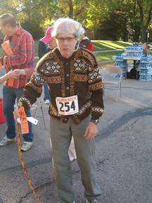
I ran the Boston Marathon in 2006 and completed the historic 26.2 mile course in 2 hours and 50 minutes and became a top Illinois finisher.
Boston Marathon pictures
Click on the following thumbnails to enlarge
»»»»»
Greenway Trails
» » »Existing
» » »Project
» » »Potential
Greenway Maps
» » »by Agency
» » »by Scope
Community Systems
» » »Active
» » »Typical
» » »Sedentary
» » »Dead-end
Grade Separations
» » »Existing
» » »Needed
Trail Development
» » »News
» » »Events
Greenway Advocacy Materials
Bicycle Underpass/Overpass Gallery
About Greenway Planning Database
About Steve Breese
PalatineRoad.com
Contact Steve Breese
Greenway Links
ArlingtonTrotters.com
Fast Track Racing Team
COGO
Technical Corner

 (24 kb)

 (1.0 Mb)